The planned excavation operation at the RILAUV.01 and RILAUV.02 sites in the heart of the Écrins National Park, in the Lauvitel integral reserve (Oisans, Northern Alps), is part of a wide-ranging study of the social and natural dynamics of long-term agropastoral activities in the high Alpine massifs, carried out for over 25 years by the alpine archaeology team at the Centre Camille Jullian.
Context
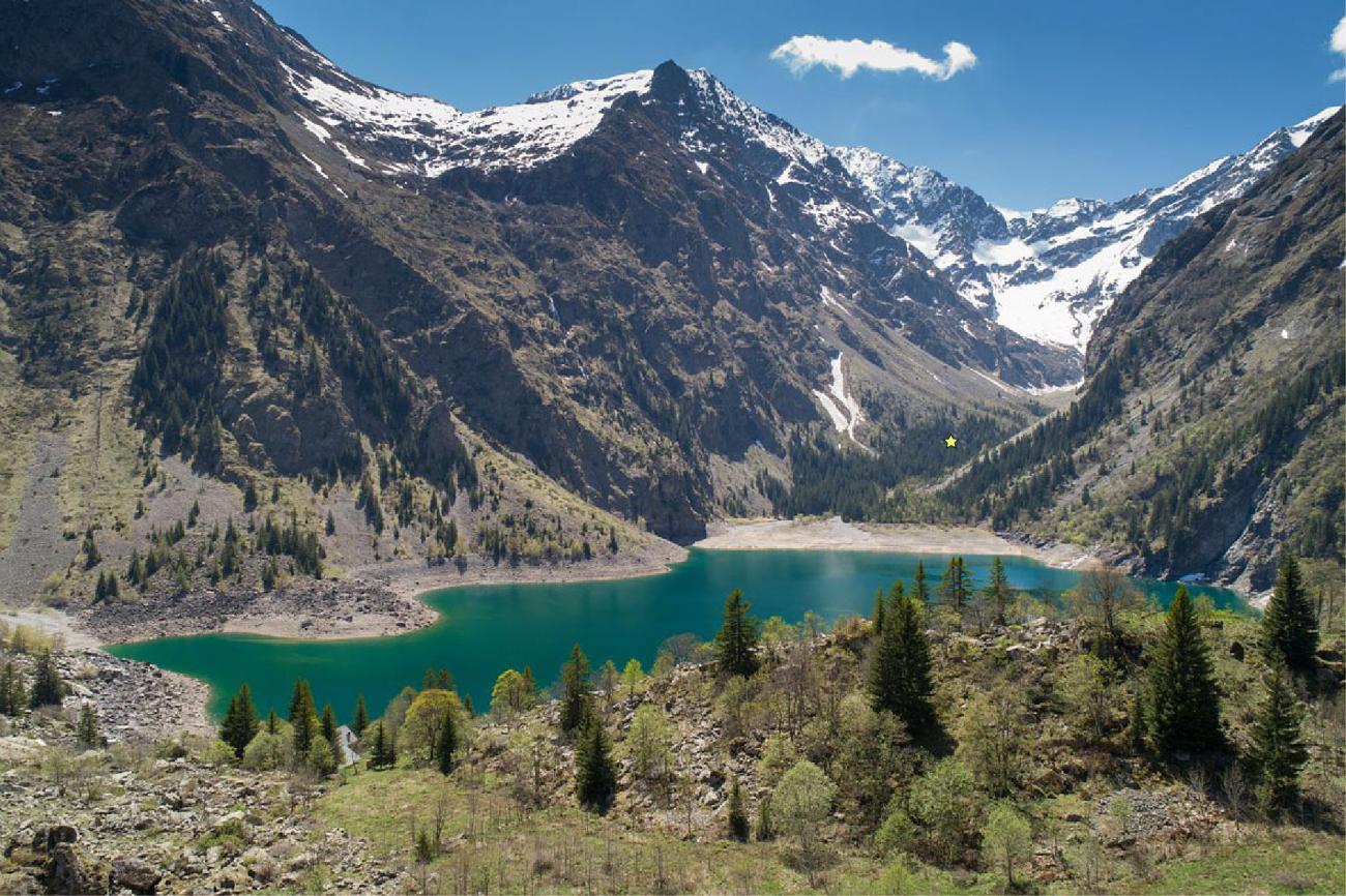
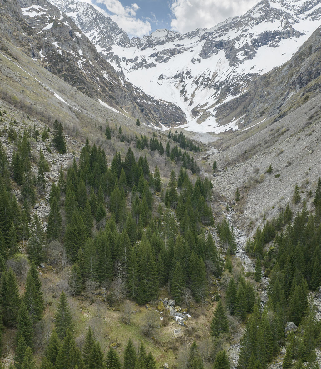
In the heart of the Ecrins-Pelvoux crystalline massif, in the commune of Bourg d'Oisans (38), the archaeological sites of RILAUV. 01 (rock shelter) and RILAUV.02 (ruined structure) are located in the heart of the Lauvitel integral reserve. Access to this restricted area, created to the south of Lac du Lauvitel and accessible only by boat, is strictly reserved for park staff and scientists (alt. 1495-3169 m). The only data on human activities were provided by a historical overview of the valley during the modern and contemporary periods and by the work of paleoecologists from the EDYTEM laboratory (Chambéry). Since 2020, archaeological operations have been carried out in the Lauvitel valley and reserve (diachronic survey-inventory, programmed excavation, field surveys and modelling).
History of the discovery of sites RILAUV.01 and RILAUV.02
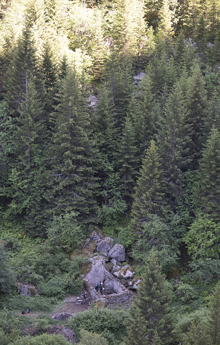
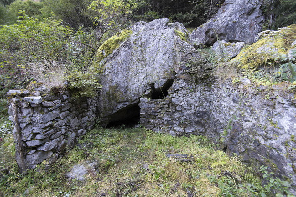
In 2012, a partially ruined agro-pastoral structure, adjoined by its north, south and east walls, and a rock shelter open to the west were identified at 1571 m altitude, on a terrace overlooking the right bank of the torrent de la Pisse. Located within a maple and mountain ash fruticity which, from 1995 onwards, had colonized an open environment (alpine grassland), these remains were completely hidden under vegetation (shrubs, woody plants, mosses, lichens, etc.). This Training corresponds to a transitional intermediate stage in the vegetation succession that will lead, in the short term, to a dense mixed forest of deciduous trees, spruce and shrubs around and in the archaeological sites. In 2020, the Parc national des Écrins (coordination J. Forêt) and V. Dumas (Centre Camille Jullian) undertook a preliminary plan of the remains and photogrammetry of the inner and outer facings of the raised structure and the cleared interior of the shelter.
Results
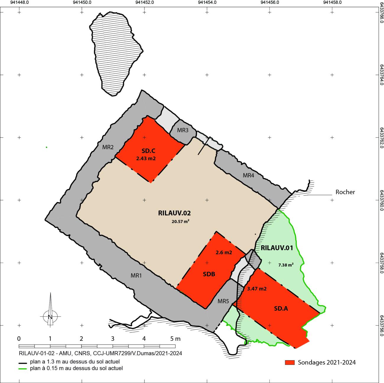
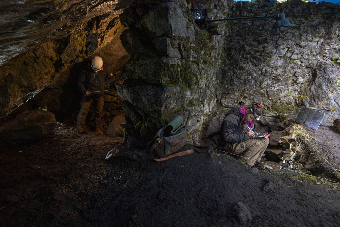
Between 2021 and 2024, three archaeological excavation campaigns were carried out, taking into account the inherent constraints of the mountain environment (no electricity, no storage facilities, isolation) and the requirements of the nature reserve (limited working time, protected area). Test pits A and B, located on either side of the high wall between the shelter and the hut (MR5), were designed to document and highlight the different phases of occupation of the internal space of the shelter and the external area; test pit C was designed to provide an understanding of the morpho-sedimentary sequences, anthropogenic processes and topography of the site.
The internal space of the shelter was small (6.79 m2), with a height of between 0.50 and 1.40 m from the current floor. The entrance was 3.66 m wide before the 2.44 m MR5 wall was erected. Today's access is through an opening 1.56 m wide and 0.50 to 1 m high. The ruined structure, rectangular in shape, has an internal surface area of 20.57 m2 ; it comprises five walls of unsquared blocks, preserved over 1.46 m to 3.55 m in elevation. Based on the stratigraphy, construction of this hut has been dated to between the 19th and early 20th centuries.
Based on current knowledge, the results reveal diachronic human occupation between prehistory and the mid-20th century. Nineteen phases of human occupation and natural processes constituting seven states are identified on the basis of stratigraphic analysis, lithic and ceramic mobiliers and 14Cdating of developments and events. Six chronological periods are represented: Prehistory, Antiquity, the Middle Ages (mid-11th-mid-13th c.), the Late Middle Ages (14th-early 15th c.), the Modern Period (16th-18th c.) and the Contemporary Period (19th-mid-20th c.). Archaeological furniture from the contemporary and modern (ceramics, glass, coins, fauna, metal objects), medieval (ceramics, fauna, metal objects), ancient (ceramics) and prehistoric (lithic objects and CNT) periods are associated with these finds.
The shelter and adjoining outdoor area have been used since recent prehistoric times (presence of lithic artefacts scattered in later levelling fill or colluvium). Circulation floors are associated with the medieval period: for the central Middle Ages, a more or less rubbed clay surface, partially identified in the shelter and on its outer edge, is linked to the presence of a hearth; for the late Middle Ages, the soil, partly rubbed, is clearly associated with post holes. The first, dating from the late 16th to early 17th century, features a pavement of large, unsquared granite blocks; the second, dated from the second half of the 17th century, is an arrangement of granite blocks and a few slate roofing stones, which extends outwards to a compact silty surface. The latest campaign, in October 2024, revealed a succession of combustion structures (hearths, hearth plates) inside and outside the shelter, beneath the central Middle Ages levels, which are currently being 14C-dated.
The furniture consists of more than a hundred lithic pieces, 360 ceramic fragments from all periods, 550 bone or dental remains (including five modern or contemporary hard animal artifacts from the bone industry) and 85 metal objects. The presence and conservation of ceramics (study by Guergana Guionova, LA3M) and fauna (study by Juliette Knockaert, CCJ) are particularly noteworthy, as they are relatively rare, if not absent, in high-altitude areas of the Alpine Arc. The study of contemporary, modern and medieval ceramics attests to a punctual living environment, with some forms used for fire and others for food consumption; these forms come mainly from regional production, but also from the Gard (Saint-Quentin-la-Poterie) and the Bouches du Rhône (Saint-Zacharie). The study of the fauna brings new elements to the discussion of diet, anthropic practices, the nature and period of frequentation of the site, and the pastoral history of the valley between the medieval period and the twentieth century. Finally, as part of an AMU Master 2 internship, sponsored by the Parc national des Écrins, Robin Veyron carried out an archaeo-anthracological study of combustion residues from medieval and modern contexts. The results highlight a wood supply area linked to the topographical position of the site and the heterogeneity of the surrounding landscapes (this study is continuing as part of a doctoral contract on the Écrins massif).
Scientific managers
- Florence Mocci (CNRS - CCJ)
- Stéfan Tzortzis (Ministry of Culture - ADES)
- Vincent Dumas (CNRS - CCJ)
Institute laboratories involved
- Center Camille Jullian (CCJ)
- Mediterranean Laboratory of Medieval and Modern Archaeology (LA3M)
- Mediterranean Institute of Biodiversity and Marine and Continental Ecology (IMBE)
- Laboratory of bio-cultural anthropology, law, ethics and health (ADES)
Partner institutions and teams
- PACA regional archaeology service
- Ecrins National Park
- MSH Mondes (CNRS - Université Paris Panthéon-Sorbonne - Université Paris Nanterre)
- Mountain Environments, Dynamics and Territories Laboratory (EDYTEM - Grenoble)
- Auvergne-Rhône-Alpes Regional Department of Cultural Affairs