Since 2017, the Centre Camille Jullian has been one of the main partners of the MEGA program, which marks a resumption of the École française de Rome's field activity at Megara Hyblaea after several years devoted to the publication of ancient excavations. This operation has been strongly supported by Aix-Marseille Université and the Institut d'archéologie méditerranéenne since 2020. It has been part of the MANTA Network project since 2024.
Background and history
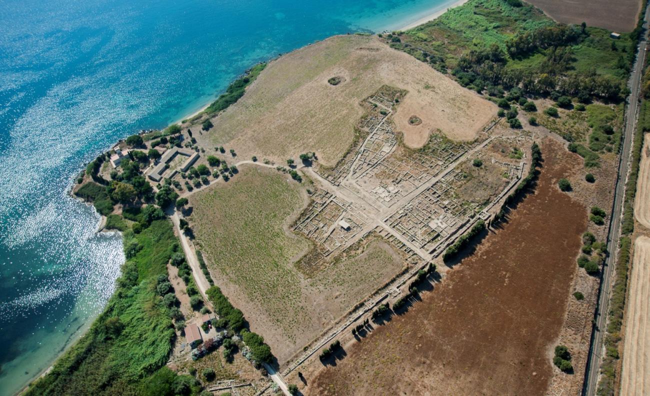
Located on the east coast of Sicily, 22 km north of Syracuse, the Greek colony of Megara Hyblaea was founded in the second half of the 8th century BC, probably by settlers from Megara in Greece. It underwent two major phases of occupation, in the Archaic and Hellenistic periods.
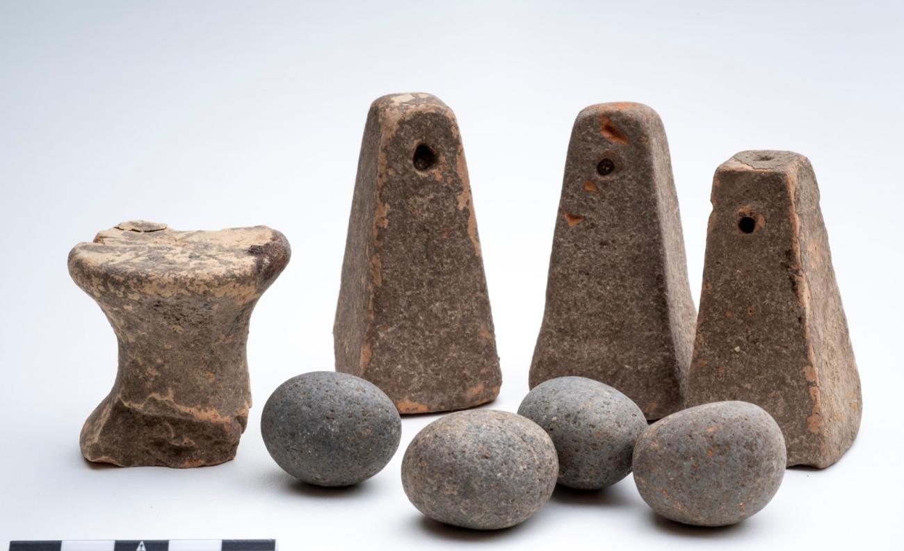
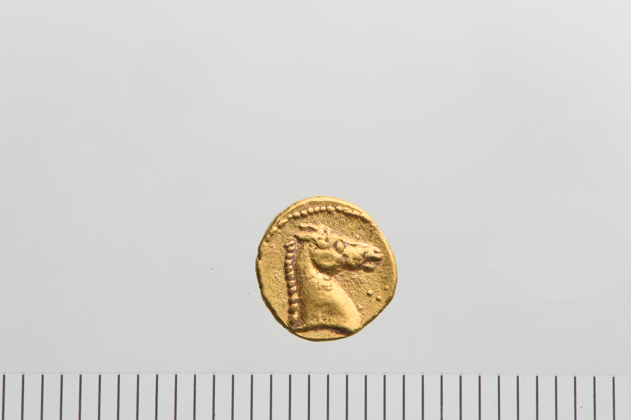
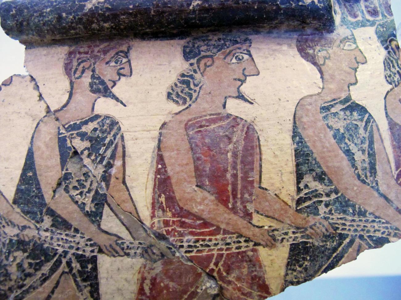
Excavated in the late 19th century by the Italian archaeological services, notably by the famous archaeologist Paolo Orsi, and from 1949 onwards, as part of a long and fruitful collaboration between the École française de Rome and the Archaeological Superintendency of Syracuse, it is now a benchmark in colonial archaeology: it is the only first-generation Archaic settlement for which both the archaeological remains of the urban center and the surrounding burial grounds have been excavated. This work has been the subject of numerous articles and several recent monographs: Megara Hyblaea 5 on the Archaic city (2004), Megara Hyblaea 6.1 and 6.2 on the southern Archaic necropolis (2017-2018), Megara Hyblaea 7 on the Classical, Hellenistic and Roman city (2018), then in 2021, Frédéric Mège's book, Le fait urbain en Sicile hellénistique. L'habitat à Mégara Hyblaea aux IVe et IIIe siècles av. J.-C. and finally in 2022 the catalog of the exhibition 'Lo regno della morta gente': la necropoli meridionale di Megara Hyblaea held in 2022 and 2023 at the Museo Archeologico Regionale Paolo Orsi di Siracusa.
The MEGA 2017-2021 program
The 2017-2021 MEGA program focused on the archaic city, in the area of the northwest sanctuary. A 2006 excavation at the western gate and a series of geophysical surveys carried out between 2008 and 2013 on the western plateau had indeed revealed the existence in this sector of a network of parallel streets (E streets) that seemed to follow a different orientation to the "quarters" in the agora sector and on the southern plateau. The aim of the MEGA 2017-2021 program was therefore to better understand the organization of this district and date its emergence. The work carried out during four excavation campaigns and five survey missions enabled us to understand the various phases of the sanctuary's insertion into the urban plan of the Greek city from the 8th to the 6th century BC, and finally to establish its relationship with the ditch of the underlying Neolithic village as part of a collaboration with teams of Italian archaeologists led by Massimo Cultraro (CNR Catania) and Anita Crispino (MARPO). On a broader scale, this program has also led to the proposal of a more precise general mapping of the main urban axes and road networks, and their relative chronology, in relation to the construction of the first Archaic enclosure. This suggests a gradual growth of urban space (initially grouped around the agora, before expanding towards the western plateau conceived as a "neapolis" a generation later, at the beginning, or more broadly in the first half of the 7th century BC). At the end of this program, only one grey area remained on the Megaran archaeological map, at the confluence of the various street networks now known 2021: the Arenella valley.
The MEGA 2022-2026 program
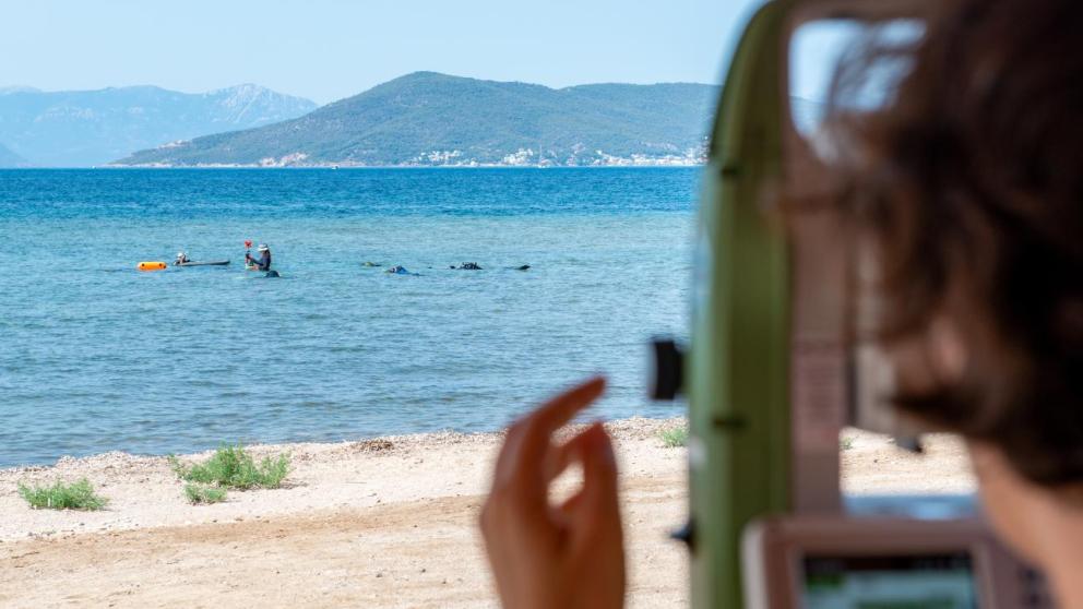
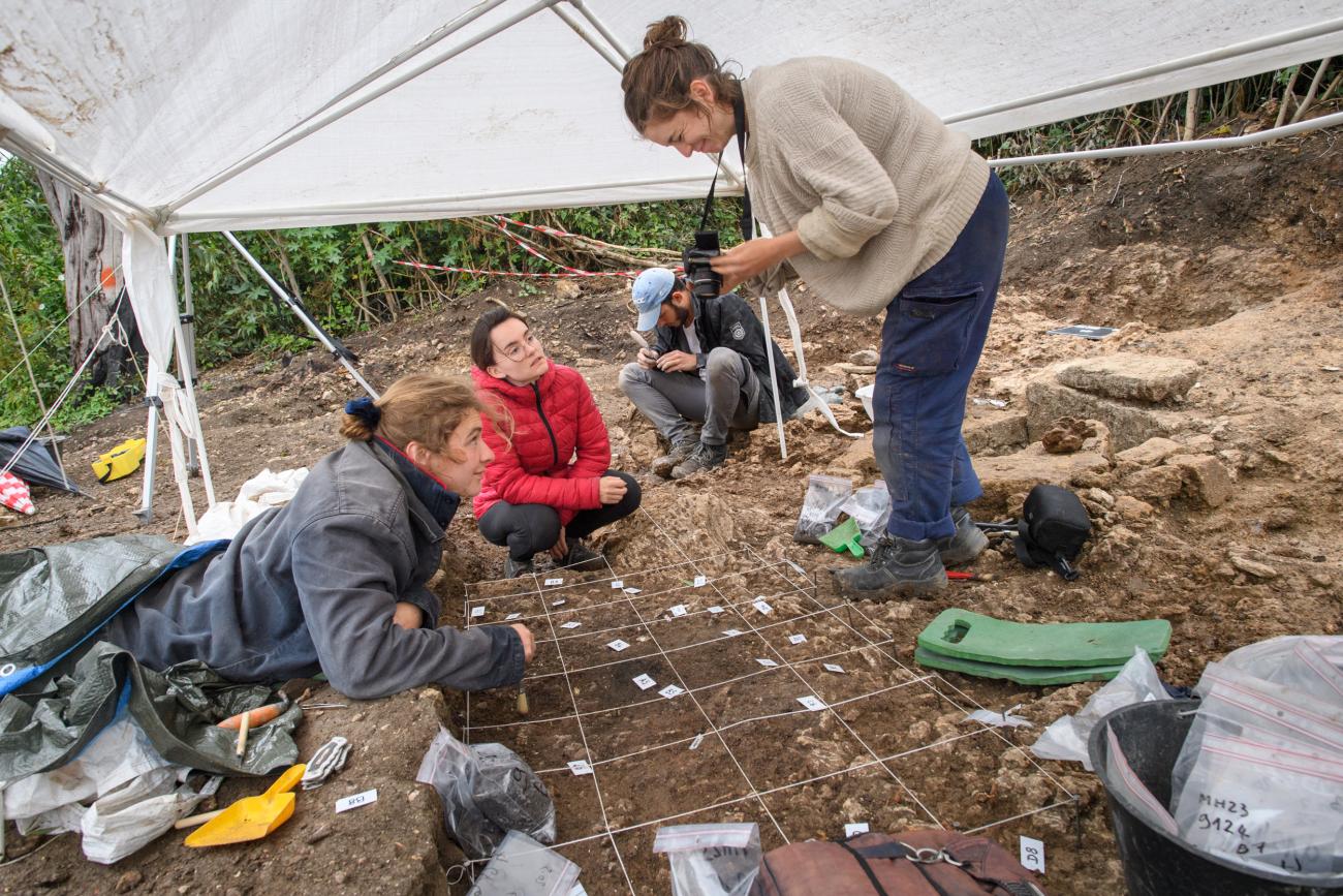
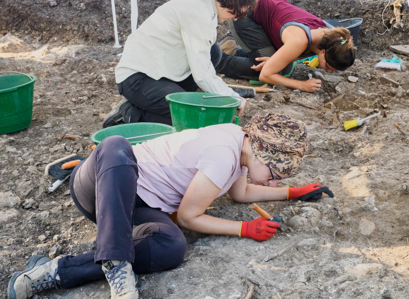
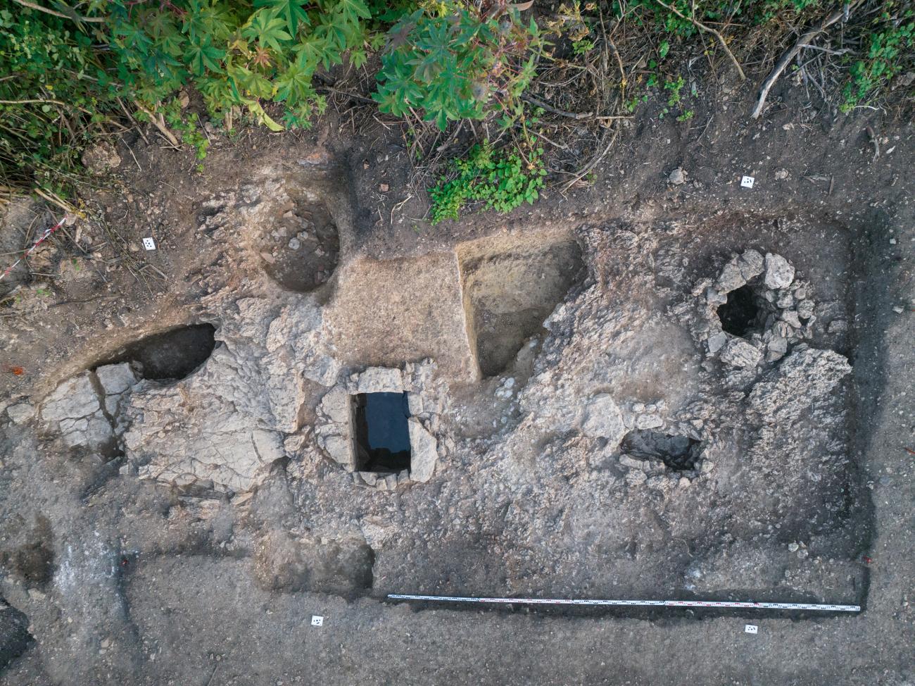
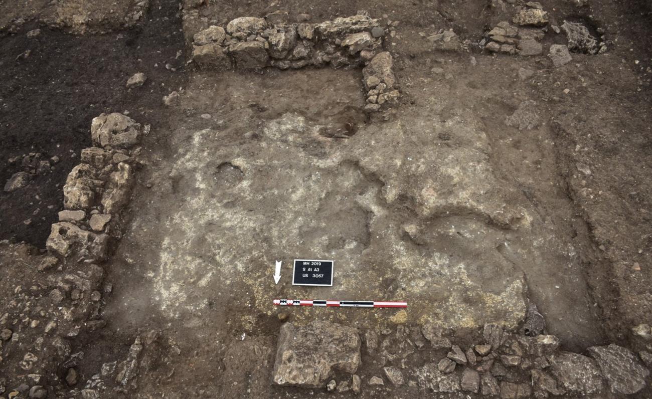
The year 2022 marked the start of a new research program at Megara Hyblaea, "MEGA 2: research in the Arenella valley", under an agreement between the École française de Rome and the Parco Archeologico de Leontinoi e Megara. This project is a continuation of the MEGA 2017-2021 program, which aimed to define the chronology and genesis of the Megarian urban plan on the western plateau. While continuing to study ancient collections with a view to their publication, this new project aims to explore the Arenella sector, the name given to the small beach and, by extension, the valley located between the North and South plateaus of Megara Hyblaea, which constitutes the only access to the sea within the limits of the Archaic enclosure.
In this area at the heart of the city, only partially known from early surveys in 1962 and 1978 and an excavation carried out between 1990 and 1992, we find monumental architectural remains, a residential area, as well as Archaic and Hellenistic tombs, whose articulation around the route of the possible seaside rampart is a major challenge for understanding the colonial urban phenomenon.
Scientific managers
- Jean-Christophe Sourisseau (Aix Marseille Université - CCJ)
- Reine-Marie Bérard (CNRS - CCJ)
Institute laboratories involved
- Center Camille Jullian (CCJ)
- European Center for Research and Education in Environmental Geosciences (CEREGE)
Partner institutions and teams
- École française de Rome
- Soprintendenza per i Beni Culturali e Ambientali di Siracusa (Italy)
- Parco archeologico di Leontinoi (Italy)
- Museo archeologico regionale Paolo Orsi (Syracuse, Italy)
- Center Jean Bérard (CNRS-EFR, Naples, Italy)
- Università degli Studi di Catania (Italy)
Further information
Press coverage
37.203797117883, 15.1827388